The plain of Valbonnais

Description

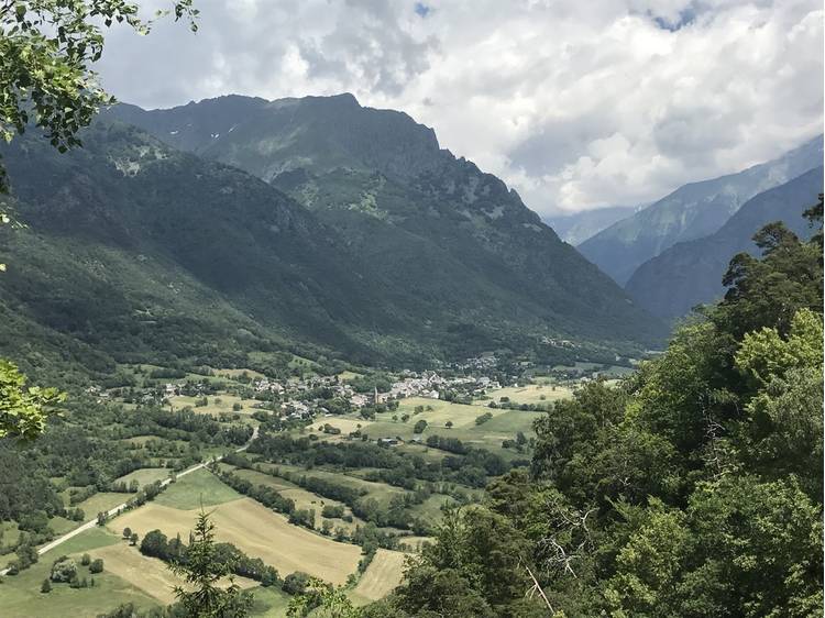
Starting from Valbonnais center, this beautiful loop hike will allow you to discover the built heritage of Valbonnais. The return will be along the "Canal des Moines"

Departure: Parking in the village center of Valbonnais

Departure from Valbonnais: from the car park in the center of the village, follow the direction "Siguret". Then turn left then left again to reach the sign “Roussillon”. Continue straight on towards the water.

Join the D526, cross it by turning left and then take the path to the right. Walk along the lake to the right to reach the sign "Pont des Verneys". Walk along the Bonne by the Chaffards dike to arrive at the "Pont des Fayettes".

Then turn right onto the D526 and follow the direction “La Roche”. Continue on the small road to the left until the sign "Sur les Veyres". Follow the path to the right which leads to Entraigues. At the end of this path at the sign "Sur le Moulin", you reach Entraigues.

Arriving at rue du Gargas (D117), take it to the right until reaching the school. After the enclosure next to the school, take the path on the left towards "Vet et Lac Gary", then a hundred meters further, at the sign "les Coteilles" turn left towards "Pont des Ayes". Cross the bridge then take a right into the meadow, climbing slightly to find a slope which leads to the sign "La Barrière". Turn left, follow the canal des Moines until the sign "Les Vignes de Leygat" then take on the right the track which returns to Valbonnais after a short climb.

Cross the old village, with its beautiful old houses nicely restored and with multiple basins, before returning to the starting point.


Track

Distance:
12 km
Level difference:
220 m
Daily duration:
3h 45min
Level:
Level bue - Medium
Type:
Loop

Rates

Free access.


Equipments

  •  Not accessible in a wheelchair
  •  Car park
  •  Pets welcome

Situation

  • Latitude: 44.900370
  • Longitude: 5.905870
Route

We suggest