Description
An itinerary in the heart of a territory that is highly «natural» and rural, dotted with pastures, meadows, lakes and forests, yet still marked by a now abandoned secular mining activity, which has helped shape the landscape.
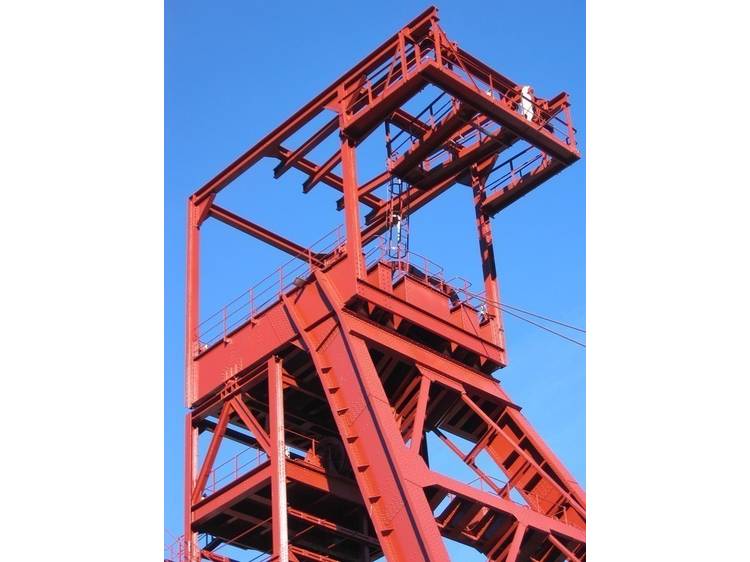
When leaving La Mure, take the D26 road towards Valbonnais, and then go to Nantes-en-Rattier via the D114. At the roundabout, take the D115 towards VillardSaint-Christophe and Cholonge. At the Cholonge intersection, make a «9 o’clock» turn to head back down towards Laffrey (around 2 km). Next, you will make a hairpin turn on your left to reach Bergogne, the Cholonge nautical base (and beach) and the Messiaen belvedere overlooking the large lake. Afterwards, you will need to reach the nearby Napoleon route, taking it on your left towards La Mure (less than 100 m) and then climbing on your right towards Les Gontheaumes. You will reach NotreDame-de-Vaulx via the Crey mountain pass, all while remaining on the D113b. Once in Notre-Dame-de-Vaulx, head towards Le Mollard via Le Majeuil, then turn left onto the D529, cross La Motte and proceed to La Mure via the La Festinière mountain pass, the Crey pond and the Villaret mining site (train station, mining town, headframe and coal reserve).
Track
- Distance:
- 37 km
- Level difference:
- 890 m
- Daily duration:
- 3h
- Level:
- Level bue - Medium
- Type:
- Loop
Rates
Free of charge.